Knowledge Space Ltd excels in distributing knowledge through an array of e-learning courses, books as well as offering world-class consultancy services. Our expertise lies in space technology, more specifically, Satellite Systems.
The courses are authored by experts in their respective fields, derived from standard text books and researched literature in harmony with the authors’ experience and recent advances in technology.
You may purchase books and courses from the Product List of this web site. We hope you will enjoy the e-learning experience.
We believe that you will recommend the courses to others.
IMPORTANT ANNOUNCEMENT: The e-learning courses are unavailable temporarily. Existing subscribers will continue to be supported.
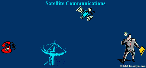
Quite simply, satellites are radio relays located in space. Because of their wide field-of-view satellite relays can connect widely separated regions – order of hundreds to thousands of kilometres- irrespective of nature of the intervening geography. A clear line-of-sight of satellite with benign radio conditions is desirable.
Satellites receive radio transmissions from Earth stations, amplify and re-transmit them towards the service region. The radio frequency (RF) and satellite transmission power depends on the application. In general smaller an Earth station receiver, the larger is the satellite transmitted power.
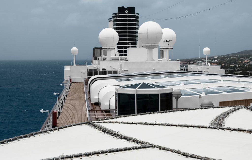
Fixed large Earth stations act as an interface between the terrestrial and satellite networks, by mapping incoming signals for the outgoing transmission medium. As such, these Earth stations are also called gateways. For personal and mobile applications the user terminals are small – portable, pocket sized, mounted on aircraft, ship, railway coach, etc.
The terrestrial network can comprise public switched fixed or mobile network, public data network, Internet or indeed a private network. Thus connectivity is possible between - fixed users, fixed-mobile users, mobile-mobile users, user-Internet, etc.
Consider a scenario where a fixed user A makes a call to another fixed user B located thousands of kilometres away. The call from user A is routed through the local terrestrial network to the satellite gateway which maps the incoming signals for the space segment and transmits them over a given satellite to the destination gateway Earth station where the call gets routed to the end user B via the destination terrestrial network. The same processes repeat in the return direction.
A majority of systems use the geostationary orbit wherein satellites appear stationary from the Earth. This is an equatorial orbit that has an altitude of about 35786 km with an inclination of 0o. At this altitude and inclination satellite motion synchronises with that of the Earth’s rotation. Geostationary satellites can cover nearly a third of the globe and hence provide instantaneous connectivity between locations separated by thousands of kilometre. We observe that the equatorial distance of 1/3rd globe is approximately 13358.4 km. [We assume a circular equator with a radius of 6378.14 km for this calculation. It transpires that geostationary satellites are not visible beyond +/- 81 deg. latitude.]
Satellite communication systems also use low and medium Earth orbit ranging between about 700 km to 24000 km. Low and medium orbit satellite systems require handovers between satellite and/or Earth stations because satellites rise and set regularly. As such, the system architecture and constellation management is more complex than geostationary satellite systems and number of satellites for a given coverage can be large but they exhibit lower propagation delay, provide full global coverage and are less demanding in power since they are closer to the Earth.
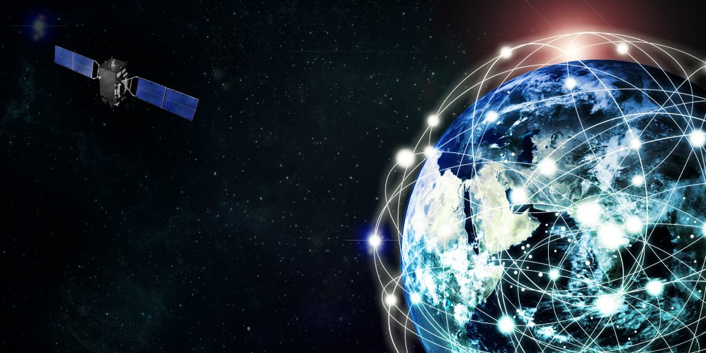
The satellite era began in 1957 with launch of the Russian Sputnik satellite. Within a span of some sixty years the technology has evolved to a level unimaginable at its dawn. Space technology now extends far beyond satellite communication – covering direct-to-home broadcasts, navigation, remote-sensing (resource monitoring, atmospheric monitoring, weather monitoring, etc.), space photography, space-tourism, inter-planetary and deep space exploratory probes, radio astronomy, etc. The satellite communication sector provides the highest revenue amongst all.
Communication capabilities have expanded from point to point communication between massive earth station to direct communication between small personal and mobile user terminals, while data rates have grown from a few kilobit/s to hundreds of megabit/s, depending on the applications and user terminal size and at the same time communication costs have plummeted. The industry has continued to grow at a healthy rate (typically 3-4% per year recently) with healthy projections for the foreseeable future. Beginning from a single international fixed satellite system, the number of international and domestic systems has proliferated and the technology has expanded to cover mobile and broadcast services for personal use. Mobile satellite services provide global services to aeronautical, maritime and land users, while broadcast services provide television, radio and multi-media services to millions around the globe The industry has now focused on developing technologies that lower communication cost/bit, lower terminal cost and size, as well as on technologies to compete and complement terrestrial consumer services.
Advanced techniques of interest include:
- high capacity and high power satellites capable of generating hundreds of spot beams delivering over a
hundred Gbit/s;
- seamless IP transport over satellite;
- use of high frequency bands – 20-30 GHz that provide large bandwidths;
- leveraging terrestrial technologies such as 3G/4G to advantage;
- use of powerful reconfigurable signal processing chips with, advanced signal-processing algorithms;
- tight and seamless integration with terrestrial networks and satellite navigation systems;
- hybrid network architecture that utilise terrestrial retransmissions to mitigate detrimental impact of fading
in urban areas.
According to September, 2014 satellite industry report produced by Satellite Industry Association, the satellite industry’s global revenue has grown from 74.3 B$ in 2004 to 195.2 B$ - i.e., nearly 2.63 times at an average growth rate of about 11%. A majority of this growth can be attributed to the satellite communication sector [Reference: www.sia.org].
| Year | Milestone | Credit |
| 1926 | First liquid propellant rocket launched by R H Goddard in the USA | |
| 1942 | First successful launch of a V-2 rocket in Germany, which technology led to development of satellite launchers | |
| 1945 | Arthur Clarke publishes his ideas of geostationary satellites for world- wide broadcast | |
| 1957 | Launch of first satellite | Former Soviet Union |
| 1958 | First American satellite launchedFirst voice communication via satellite demonstrated | USA |
| 1960 | First communication satellite (passive) launchedFirst successful launch by DELTA Launch Vehicle First remote sensing satellite TIROS-1 launched | USA |
| 1961 | Formal start of TELSTAR, RELAY, and SYNCOM Programs which led to the beginning of satellite communication as we know it | USA |
| 1962 | First active communication satellite launchedTELSTAR and RELAY satellite launchedFirst trans-Atlantic live television broadcast (TELSTAR-1)RELAY satellite used for live trans-Atlantic television broadcasts of important US events | USA |
| 1963 | SYNCOM 1 and 2 launched to develop technology for geostationary orbit | USA |
| 1964 | First satellite launched into geostationary orbit (SYNCOM-3)INTELSAT founded | USA |
| 1965 | First commercial geostationary satellite system launched (Early Bird: INTELSAT-1) | Comsat, USA |
| 1969 | Global coverage available through INTELSAT-III satellite series | INTELSAT |
| 1972 | First domestic satellite system operational (ANIK)INTERSPUTNIK foundedLandsat-1 (remote sensing) satellite launched | CanadaFormer USSRUSA |
| 1974 | First U.S. domestic communications satellite (WESTAR) | USA |
| 1975 | First use of dual-polarization (INTELSAT-IVA)Launch of first Indian satellite (Arya Bhatt) | INTELSATIndian Space Research Organization (ISRO) |
| 1975 | First successful wide-area direct broadcast demonstrations ( 1 year duration, Satellite Instructional Television Experiment) | USA/India |
| 1975 | First body-stabilized operational communication satellite | RCA/USA |
| 1976 | First mobile communications satellite launched (MARISAT)Indonesia, third country, launches domestic communication satellite system (PALAPA system) | USAIndonesia |
| 1976 | First demonstration of inter-satellite link using LES-8 satellite | USA |
| 1977 | A plan for direct-to-home satellite broadcasts assigned by the International Telecommunication Union (ITU) in regions 1 and 3 (most of the world except Americas). | ITU |
| 1977 | Mobile experiments conducted using ATS-6 | NASA, USA |
| 1978 | Start of GPS introduction | USA |
| 1979 | Inmarsat formation | International Maritime Satellite Organization/IMO/UN |
| 1980 | IMO decides to deploy satellite communications for maritime safety | UN |
| 1981 | First re-useable launch vehicle flight (American Space Shuttle) | USA |
| 1982 | Start of GLONASS introduction | Former Soviet Union |
| 1982 | First civilian mobile satellite system introduced for maritime use | Inmarsat |
| 1983 | ITU direct broadcast plan extended to region 2Beginning of Indian domestic satellite system INSAT | ITUIndia |
| 1984 | First direct-to-home broadcast system operational | Japan |
| 1987 | Successful trials of land mobile communications | Inmarsat |
| 1988 | Launch of Indian Remote Sensing Satellite–1 (IRS-1). [IRS constellation is world’s largest constellation of civilian remote sensing satellites.] | ISRO |
| 1987-89 | An architecture of LEO for mobile satellite communication proposed | University of Surrey, UK |
| 1989-90 | Global mobile communication commercial service extended to land mobile and aeronautical environments | Inmarsat |
| 1990 | First commercial satellite radio broadcast system filed | CD Radio Inc., USA |
| 1990 | First commercial non-GEO hand-held system announced | Motorola/Iridium |
| 1990-91 | Commercial land and aeronautical mobile satellite services (MSS) introduced | Inmarsat |
| 1990-92 | Several organizations/companies propose non-geostationary satellite systems for mobile communications – following Motorola. | Various |
| 1992 | GSM terrestrial mobile system introduced (Architecture used later as basis for mobile satellite systems) | Europe |
| 1992 | Major changes to mobile satellite frequency allocation | ITU (WARC 1992) |
| 1993 | Announcement of first commercial little-LEO satellite system (with secure finance) | Orbital Sciences Corporation - ORBCOMM system; USA |
| 1994 | First non-GEO fixed satellite service system announced (However, the system failed to materialize) | Teledesic Corporation; USA |
| 1994-96 | Several regional ‘super-geostationary’ satellite systems announced | Agrani (Indian Consortium) ; APMT (China/Thailand); ACes; Thuraya, etc. |
| 1995 | GPS navigation system fully operational (Project start: 1973)GLONASS (Start of development 1976) | US GovernmentFormer Soviet Union |
| 1996 | Satellite paging services announced | Inmarsat |
| 1997 | Desktop-sized mobile terminals introduced | Inmarsat |
| 1997 | First non-geostationary little-LEO satellite system introduced | ORBCOMM |
| 1997 | Frequency allocation for non-GEO fixed system | WRC 1997 |
| 1997 | Launch of first batch of LEO satellite system for voice communications (so called ‘big-LEO’) | Iridium |
| 1997 | Launch of first batch of non-geostationary satellite system for low bit rate data communications (‘little-LEO’) | ORBCOMM |
| 1997 | Mobile experiments conducted using ACTS | NASA |
| 1997 | Navigation system : geostationary overlay capability available | Inmarsat |
| 1997-98 | Start of world-wide spot beam operation for MSS | Inmarsat |
| 1998 | Introduction of first big-LEO satellite system | Iridium |
| 1998 | Introduction of dual-mode satellite-terrestrial handsets (i.e., combined satellite and terrestrial handset) | Iridium |
| 1998 | Safety of life at sea (SOLAS) treaty introduced | UN |
| 1998 | Introduction of extensive on-board processing satellites for MSS | Iridium |
| 1999-2000 | Serious financial difficulty experienced by new and proposed non-GEO MSS systemsIntroduction of Globalstar | IridiumGlobalstar |
| 2000-05 | Consolidation of new mobile satellite system operators despite financial losses | Various |
| 2005 | Launch of Inmarsat 4 – first L band high throughput mobile satellite | Inmarsat |
| 2005 | Introduction of wide-band portable land mobile communication system | Inmarsat |
| 2006-2008 | Extension of portable broadband system to mobile platforms | Inmarsat |
| 2008 onwards | Growing trend of FSS satellite system usage in mobile environment (maritime/aeronautical) | |
| 2009-10 | Announcement of next generation systems | Inmarsat, Iridium, Globalstar, ORBCOMM |
| 2009 | LightSquared proposes ATC services in USA (Satellite-terrestrial hybrid system) | LightSquared |
| 2011 | Launch of Viasat-1 : Beginning of High Throughput Satellite fixed satellite service era | Built on Space Systems/Loral |
| 2012 | ATC service license suspended in USA due to interference issues to GPS | LightSquared |
| 2012 -15 | Escalation of mobile usage in FSS band due to growing demands | Worldwide |
| 2014 | Introduction of Ka band mobile broadband | Inmarsat |
| 2015 | Start of India’s Satellite-based augmentation system (GAGAN) | Indian Government |
| 2015 | Introduction of first medium Earth orbit satellite communication system for space segment capacity lease | O3b, USA |
| 2015 | Revival of dense (mega) LEO constellation concept through several announcement for global Internet provision | |
| 2015 | Roll out of world's first Ka band civil mobile satellite system | Inmarsat |
| 2017 | LEO Next generation broadband L-band system roll out begins | Iridium |
| 2017 | Space X an American company begins commercial use of first stage reusable launchers | Space X |
| 2017-18 | Proposals for Internet provision to masses via dense constellation of low earth orbiting satellites report tangible progress | e.g., One-Web (620 satellites/1120 km orbital altitude); Space-X (4425 satellites/1100-1300 km orbital altitude) |
Satellite communication is economic when separation between users is large (hundreds of kilometre), in presence of difficult terrain or sea in-between user communities and when users move arbitrarily over a large area. Satellite systems are used extensively on international and long domestic routes; in areas where population centres are separated by large distances (e.g. Canada) or are dispersed in an archipelago (e.g. Japan, Indonesia); by mobile users travelling along maritime, aeronautical or land routes; and for broadcasts over large regions like Europe or India.
Satellite systems are also used to provide telecommunication services to isolated communities such as those in Scottish highland.
Ground terminal antenna and hardware size and costs have reduced such that terminals can be installed in customer premises. These very small aperture terminals (VSATs) can:
- bypass public switched networks cost-effectively;
- eliminate delays and fault associated with PSN;
- enable instant service access.
Numerous applications in auto, retail, business and personal broadband sectors have emerged as a result.
One of the fastest growth areas understandably is that of mobile communications because satellites provide unbiased coverage over wide areas including oceans, inter-continental flight corridors and large expanses of land mass where deployment of terrestrial systems is difficult. Additionally, a mobile satellite communication system can provide international roaming facility instantly provided regulatory and inter-operator formalities are in place.Further, satellite systems provide:
- invaluable communication support in situations of natural disaster, such as earthquake, when terrestrial systems have been disrupted;
- live television broadcasts to ships and other mobiles;
- location-based service like fleet management;
- instant contact with news reporters covering events in remote and far-flung areas;
- distress communication service to ships, aircrafts, land mobiles and individuals;
- world-wide voice and data service;
- television and sound broadcast to large unserved geographical areas;
- direct broadcast services in developed and developing regions such as the US and Europe, India despite strong competition from terrestrial television delivery systems;
- Full coverage over vast areas immediately after satellite deployment.


Satellite communication networks require enormous start-up costs and gestation lasting several years. A careful techno-economic study is therefore essential before taking up such a venture.
There can be loss of service to vast areas if a satellite were to fail or malfunction. Fortunately, the reliability of launchers and satellite has improved. Many satellites continue to provide good service far beyond their design lifetime. The problem of in-orbit catastrophic failure is solved by deploying an in-orbit spare or by a fall-back arrangement with another operator.
Geostationary satellite systems exhibit a larger transmission delay than terrestrial system due to greater propagation path. The problem is exacerbated when the delay is accompanied by echo caused by a mismatch between terrestrial and satellite system interface. It is under these circumstances that telephone users suffer the worst annoyance. A great deal of advance has been made in echo suppressors/cancellers technology reducing the echo problem to a minimum. In particular, the delay associated with two satellite hops becomes excessive.
Low and medium Earth orbits are used to reduce delay and down-time in case of a satellite’s catastrophic failure.
End user costs for consumer/business applications are higher than those of terrestrial systems, although cost per bit continues to reduce with modern high throughput satellites.
Satellite broadcast system comprise a program source, such as a studio or a remote camera covering an event, connected to an earth station linked to a broadcast satellite typically operating in Ku band. The audience receives these transmissions from the satellite on low-cost direct broadcast receivers.
Satellite communication is economic when separation between users is large (hundreds of kilometre), in presence of difficult terrain or sea in-between user communities and when users move arbitrarily over a large area. Satellite systems are used extensively on international and long domestic routes; in areas where population centres are separated by large distances (e.g. Canada) or are dispersed in an archipelago (e.g. Japan, Indonesia); by mobile users travelling along maritime, aeronautical or land routes; and for broadcasts over large regions like Europe or India.
Satellite systems are also used to provide telecommunication services to isolated communities such as those in Scottish highland.
Ground terminal antenna and hardware size and costs have reduced such that terminals can be installed in customer premises. These very small aperture terminals (VSATs) can:
- bypass public switched networks cost-effectively;
- eliminate delays and fault associated with PSN;
- enable instant service access.
Numerous applications in auto, retail, business and personal broadband sectors have emerged as a result.
One of the fastest growth areas understandably is that of mobile communications because satellites provide unbiased coverage over wide areas including oceans, inter-continental flight corridors and large expanses of land mass where deployment of terrestrial systems is difficult. Additionally, a mobile satellite communication system can provide international roaming facility instantly provided regulatory and inter-operator formalities are in place.Further, satellite systems provide:
- invaluable communication support in situations of natural disaster, such as earthquake, when terrestrial systems have been disrupted;
- live television broadcasts to ships and other mobiles;
- location-based service like fleet management;
- instant contact with news reporters covering events in remote and far-flung areas;
- distress communication service to ships, aircrafts, land mobiles and individuals;
- world-wide voice and data service;
- television and sound broadcast to large unserved geographical areas;
- direct broadcast services in developed and developing regions such as the US and Europe, India despite strong competition from terrestrial television delivery systems;
- Full coverage over vast areas immediately after satellite deployment.
Satellite links are prone to bit errors and propagation delay which can be problematic for some types of data applications.
The severity of problem depends on the desired quality of service i.e. acceptable time delay, bit error rate and throughput.
TCP/IP data protocols are in abundant use. These protocols are sensitive to bit error and time lag inherent in satellite systems. Various solutions are commercially available to minimize the impact.
Satellite resource allocation systems are designed to provide the user-negotiated quality of service. For example streaming and interactive applications require a continuous connectivity, unlike E-mails which do not require instant delivery. Bit error rate is reduced to acceptable level through powerful coding techniques, some of which can approach theoretical bound and by automatic request protocols that are based on retransmission requests when an error is detected at the receiver.
Satellite communication provides a powerful medium for continuous communication to the railways in remote locations and harsh environmental conditions. Typical applications include broadband connectivity to travellers and to railway operators for railway management services such as security and surveillance by remote monitoring.
A typical system utilizes a railway terminal to provide connectivity to terrestrial networks via an L, Ku or Ka band satellite and a large ground earth station (a fixed gateway). The railway terminal is a mobile gateway for railway users who connect over an in-train Wi-Fi network.
The railway antenna has a low profile typically less than 30 cm high to minimize air friction and avoid collision with tunnel top. The high gain antenna has an agile tracking system capable of acquiring satellite quickly after an interruption. It is easily installable and can withstand vibrations and shocks typical of a train.
The space segment utilizes a standardized air interface such as DVB-S + M with low-cost satellite capacity for commercially viability.
Satellites are used widely to broadcast special events such as Olympics, cricket and football matches, car or maritime rally, war footage, natural disasters, etc.
For one-off footage from remote locations, portable satellite equipment is in wide use. For events of longer durations such as Olympics, the arrangements are more elaborate using a variety of equipment ranging from dedicated mobile units to improvised very small aperture terminals and satellite capacity available at the site.
The selection of equipment and space segment depends very much on the entity responsible for the broadcast. It could be a government sponsored unit or a private venture. Each would have a preference of selection of the space segment.
ITU-T Recommendation G.114 should be consulted. The recommendation provides guidance about effects of end-to-end one-way delay (latency) on voice communication and recommends an upper bound for one-way network delay.
While G.114 recommends that latency of 400 ms should not be exceeded for general network planning, it cautions that highly interactive tasks (e.g., voice calls, interactive data applications, video conferencing) can be affected adversely by higher delays. The recommendation provides a curve derived from the E-model (ITU-T Rec. G.107) illustrating the effect of delay below 500 ms on conversational speech.
It should be recognized that in an end-to-end voice or data connection there are additional sources of delay such as voice codec, echo cancellers, packet assembly/disassembly circuits, modulation-demodulation processes, coding/decoding processes, trans-multiplexers and sub-systems in digital telephone exchanges.
One-way propagation delay associated with satellite systems are exemplified as follows:
Orbit altitude (km)
400
14000
36000
One way delay (ms)
12
110
260
Communication and transmission security coupled with low probability of detection and interception, survivability, terminal robustness, coverage and connectivity in areas of interest are key requirements for military assurance.
Communication security is obtained through highly secure encryption techniques at originating points. The strength of chosen encryption depends on the type of data in question - sensitive, classified, secret, top secret, etc.
Transmission security is improved through a variety of countermeasures that include jam resistant, adaptable signal waveforms, e.g., spread spectrum and frequency hopping.
Countermeasures that lower probability of detection and interception utilise advanced signal processing techniques. For instance, uplink adaptive beam forming minimizes the probability of detection and very narrow transmission beam-width reduces the probability of interception.
Military satellites are susceptible to physical or electromagnetic attacks like nuclear burst, lasers, particle beams and others. Survivability is improved through hardened components; clever use of orbital parameters to reduce the susceptibility of satellites to physical damage; survivable satellite constellation design that provide redundant transmission paths and in-space connectivity.
The user terminals are required to operate in very hostile conditions and environments. Therefore they are ruggedized. Implementation ranges from hand-held terminals to those installed on rapidly moving platforms like war fighters.
Selection of orbit depends on the desired coverage and orbital robustness. Therefore geostationary, low, medium and highly elliptical orbits or combinations thereof can be used.
Please see answer to the previous question.
K-band satellite links are severely affected by rain. As an example, for the temperate continental climate regions of the USA the link margin required for 99.9% link reliability is 10 dB at 20 GHz, increasing to 20 dB for 30 GHz link at moderate elevation angles. Rain attenuation is inversely related to elevation angle. Cross-polarization discrimination is also affected by rain – its magnitude being influenced by frequency, co-polar attenuation and polarization.
Time-of-day has a strong correlation with ionospheric scintillation, which is very weak at such frequencies. Tropospheric scintillation does not correlate with time-of-day. Satellite movement is a time-of-day variable that can cause minor variations in received signal in large antennas unless tracked out.
Attenuation by clouds and fog depends on their liquid content. The largest attenuation from clouds in fair weather is equivalent to that caused by light rain (~10 mm/hr). The attenuation from fog can be considered negligible for practical purpose as the liquid content is low and their radio path length through path is small (~50-100 m).
Attenuation caused by sand storms depends on the frequency, type and density of dust particles, length traversed by radio waves in the sand storm, height of the user terminal. As an example, one theoretical study estimates the average attenuation as about 0.2 dB/km in an African region, observing that attenuation increased significantly as dust density increased.
The reader should refer literature for more details.
As the name suggests, Indian satellite system or INSAT is a satellite communication system that serves India. It has been a catalyst to the development and maturing of India’s telecommunication infrastructure continuing to play a vital role in business, personal applications including disaster management and rural connectivity.
Please use the following link to ISRO’s website for a first-hand information of INSAT system capabilities.
http://www.isro.gov.in/applications (Retrieved November 2015)
Digital methods offer the following advantages over analogue satellite links.
Digital coding improves robustness of radio frequency to noisy satellite signals, typical of a satellite receiver, to deliver high quality reproduction – advanced coding schemes such as Turbo coding can approach theoretical limits in channel utilization (Shannon limit).
Digital processing can regenerate digital signals in regenerative satellite transponders and retransmit them afresh thereby decoupling up and down links – thus providing high power efficiency and noise rejection that leads to smaller earth stations and improved interference rejection compared to non-regenerative and transponders carrying analogue traffic.
Digital techniques allow encryption to offer highly secure communication.
Voice coding has reached such sophistication that communication is possible at bit rates down to 2.4 kb/s.
Digital systems do not differentiate between signal types – thus voice, computer data, imagery and digital signals from other sources can be multiplexed into a single transmission stream thereby improving transmission efficiency.
Advanced digital techniques can stuff useful data between speech or data pauses to fully utilise otherwise wasted bandwidth – typically a voice channel is occupied for about 40% of time.
Large scale device integration has allowed massive all round reduction in cost, size and efficiency enabling introduction of hand-held user terminals; on-board digital processing allowing features such as traffic dependent beam reconfiguration in real time, software reconfigurable transmitter and receivers, etc.
Digital systems can be reprogrammed locally or remotely thus improvements can be introduced without need of changing hardware.
Digital multiple access techniques such as Time Division Multiple Access (TDMA), Time Division Multiplexed (TDM) streams make highly efficient use of shared satellite transponders.
All modern satellite systems are digital due to overriding advantages of digital systems.
Satellite is a natural or man-made object in space that moves in a regular path around a star or a planet. The path traversed by the object is known as its orbit. Moon is an example of a satellite orbiting the planet Earth. The Earth is an example of a satellite orbiting a star – our sun. GPS satellites are an example of man-made satellites orbiting the Earth.
An artificial satellite is a satellite made by humans.
Communication satellites receive signals from ground transmitters, commonly known as Earth stations. Since the received signals are very weak these signals are amplified, processed and retransmitted towards desired regions of the Earth.
Conventional satellites (the majority) simply amplify the weak signals before transmissions. Satellites using advanced technology can modify the received signals to adapt them better for retransmissions. For example satellites may receive transmissions in time divided bursts and retransmit them in a continuous stream, combining individual bursts.
In broad terms satellites comprise a platform or ‘bus’ and a payload. The bus assists in maintaining satellite’s attitude and orbit, accepts ground originated commands, assists ground station tracking by transmitting a beacon, provides DC power, maintains thermal equilibrium and provides desired structural support, The payload performs the task related to communication. It comprises a repeater, which processes the received signals and readies them for transmission, and antennas, which collect and distribute the radio frequency signals in the service area.
A majority of communication satellites are located in a geostationary orbit wherein satellites appear stationary from the Earth. At an orbital altitude of about 35786 km and an inclination of 0o a satellite’s orbital motion coincides with that of the Earth’s axial rotation. Thus a satellite in this orbit appears stationary from the Earth. Geostationary satellites can cover up to 1/3rd of the globe and hence provide instantaneous connectivity between locations separated by thousands of kilometre noting that the equatorial distance of 1/3rd globe is approximately 13358.4 km. We assume a circular equator with an average radius of 6378.14 km for this calculation.
Several systems use low Earth orbit (LEO) or medium Earth orbit (MEO) ranging in altitude between about 700 km and 24000 km. LEO and MEO satellite systems require handovers between satellite or Earth stations because satellites rise and set regularly. As such the system architecture and constellation management is more complex than geostationary satellite systems.

In broad terms communication satellites comprise a platform or ‘bus’ and payload. The bus assists in maintaining satellite attitude and orbit, accepts ground originated commands, assists ground station tracking by transmitting a beacon, provides DC power, maintains thermal equilibrium and provides desired structural support. The payload is responsible for the primary task - that of communication. It comprises a repeater, which processes the received signals and readies them for transmission, and antenna system, which collects and distributes the radio frequency signals in the service area.
Communication satellites receive signals from ground transmitters, commonly known as Earth stations. Since the received signals are very weak these signals are amplified, processed and retransmitted towards desired regions of the Earth.
Conventional satellites (the majority) simply amplify the weak signals before transmissions. Satellites using advanced technology can modify the received signals to adapt them better for retransmissions. For example satellites may receive transmissions in time divided bursts and retransmit them in a continuous stream, combining individual bursts.
In broad terms satellites comprise a platform or ‘bus’ and a payload. The bus assists in maintaining satellite’s attitude and orbit, accepts ground originated commands, assists ground station tracking by transmitting a beacon, provides DC power, maintains thermal equilibrium and provides desired structural support, The payload performs the task related to communication. It comprises a repeater, which processes the received signals and readies them for transmission, and antennas, which collect and distribute the radio frequency signals in the service area.
Satellite communication is economic when separation between users is large (hundreds of kilometre), in presence of difficult terrain or sea in-between user communities and when users move arbitrarily over a large area. Satellite systems are used extensively on international and long domestic routes; in areas where population centres are separated by large distances (e.g. Canada) or are dispersed in an archipelago (e.g. Japan, Indonesia); by mobile users travelling along maritime, aeronautical or land routes; and for broadcasts over large regions like Europe or India.
Satellite systems are also used to provide telecommunication services to isolated communities such as those in Scottish highland.
Ground terminal antenna and hardware size and costs have reduced such that terminals can be installed in customer premises. These very small aperture terminals (VSATs) can:
- bypass public switched networks cost-effectively;
- eliminate delays and fault associated with PSN;
- enable instant service access.
Numerous applications in auto, retail, business and personal broadband sectors have emerged as a result.
One of the fastest growth areas understandably is that of mobile communications because satellites provide unbiased coverage over wide areas including oceans, inter-continental flight corridors and large expanses of land mass where deployment of terrestrial systems is difficult. Additionally, a mobile satellite communication system can provide international roaming facility instantly provided regulatory and inter-operator formalities are in place.Further, satellite systems provide:
- invaluable communication support in situations of natural disaster, such as earthquake, when terrestrial systems have been disrupted;
- live television broadcasts to ships and other mobiles;
- location-based service like fleet management;
- instant contact with news reporters covering events in remote and far-flung areas;
- distress communication service to ships, aircrafts, land mobiles and individuals;
- world-wide voice and data service;
- television and sound broadcast to large unserved geographical areas;
- direct broadcast services in developed and developing regions such as the US and Europe, India despite strong competition from terrestrial television delivery systems;
- Full coverage over vast areas immediately after satellite deployment.
Participating ground stations do not require elaborate tracking as required by other types of orbits. Radio links and interference environment are (nearly) invariant and stable, which simplifies radio link design and inter/intra-system interference management. Small Earth stations can use fixed antennas enabling low cost receivers for mass use while large Earth stations can use simple and low-cost tracking system such as step track. The network architecture is simple.
Although geostationary satellites are said to be stationary, in practice they do move about slightly sometimes by up to 3 degrees a day in a repetitive pattern. This order of movement is easily absorbed by small antennas as used in direct broadcast receivers and small fixed receivers since satellite movements are well within their field-of-view.
Due to large distance of geostationary satellites from the Earth, the free space loss and propagation delay is significant.
Satellites in geostationary orbit cannot cover the polar region. Launch costs tend to be high and spectrum efficiency is lower than low and medium Earth orbit satellite systems. There is a risk of large regions suffering outage in case of a catastrophic satellite failure.
Low and medium Earth satellite exhibit lower propagation delay resembling terrestrial systems. These orbits can provide full global coverage. Power requirements in space and ground segments are lower than those of geostationary satellite since satellite-ground distance is lower. The outage in case of a catastrophic satellite failure is not total as other satellites can fill the coverage gap.
Low and medium Earth orbit require a large number of satellites for global coverage. Due to their high motion, received signal frequencies suffer large Doppler frequency drift; moreover radio link suffers highly variable signal levels. Network architecture is complex with need of handover or inter-satellite link, etc. and interference management is complex. Deployment and constellation maintenance is complex. Probability of increasing orbital debris from failed satellites increases.
Geostationary satellites can be launched directly into orbit. However, it is usual to launch them in a sequence outlined below. Velocity increment is least when a satellite is launched from a parking orbit to an intermediate elliptical orbit known as transfer orbit which has an apogee at geosynchronous altitude and then injected into a geo-synchronous orbit. This principle is called Hohmann Transfer, named after the scientist who proposed the principle in 1925.
1. Launch into a parking orbit;
2. Transfer into a transfer orbit;
3. Inject into an inclined geo-synchronous orbit;
4. Make orbital adjustments such that inclination is near zero;
5. Drift satellite to desired orbital location;
6. Conduct orbital maneuvers to fix satellite at desired location.
When a satellite reaches its designated location, its solar panels are deployed, the Sun and the Earth are acquired, and communication antennas deployed. The satellite sub-systems are checked out and the satellite commissioned.
Deployment of a non-geostationary constellation quickly and economically is vital for commercial success of the system. Therefore launching of multiple satellites per launch is a common practice – existing vehicles can launch 3–12 satellites in a low Earth orbit. Satellites may be placed in low or medium Earth orbit directly or via a parking orbit. Typically, a launcher deposits clusters of satellites at regular intervals in a parking orbit. When a precise orbital position of each cluster has been determined, each satellite within is maneuvered to the desired altitude and inclination by firing onboard thrusters for a specific duration at an appropriate time. Support of a network of tracking stations dispersed throughout the world is essential to accomplish the desired goal.
Satellites are not used for tracking any particular mobile phone.
Mobile phones estimate their own position from signals transmitted by satellite navigation systems such as GPS and GLONASS. The location information, stored within the phone, can be transmitted to another user by an application thus revealing its location.Location of a mobile can be tracked through terrestrial mobile systems using technique such as triangulation and other techniques available only to law enforcement agencies. Nevertheless, location of a mobile’s resident cell is always known by the network since the mobile continually updates its position at a cell level.
Satellites communicate with the Earth over radio links at frequencies assigned by the operator. These frequencies are in line with the prevailing Radio Regulations.
Transparent transponders receive signals, amplify and retransmit the received signal on a different frequency. Advanced repeaters can extract information and retransmit them in a different format better suited for the downlink. Such satellites can also route the signals intelligently to make the best use of satellite power and spectrum.
According to 2016 Satellite Industry Organization (www.sia.org), there were a total of nearly 1486 operational satellites at the end of the year 2016 of which 520 were in geostationary orbit. Their distribution in usage (rounded) is approximated as follows:
Communications
Earth observation
Government communication
Research & Development
Navigation
Military surveillance
Scientific
Meteorology
Non-profit communication
Space observation
35%
19%
14%
12%
7%
6%
5%
2%
1%
1%
A communication satellite consists of two functional units - payload and bus.
The function of the payload is to fulfill the primary goal of the mission – i.e., communication, remote-sensing, business goals, etc. The bus provides electrical and mechanical support to the payload. The payload is made up of antenna and repeater sub-systems. The antenna sub-system captures signals transmitted from the ground stations dispersed in the service area and transmits them back towards the service area. The repeater processes the received signals and routes the signals to the antenna after amplification. The bus, (sometimes called platform) consists of several sub-systems. The attitude and orbit control sub-system (AOCS) stabilizes the spacecraft and controls its orbit. The propulsion sub-system provides the necessary velocity increments and torques to the AOCS. The telemetry, tracking and command (TT & C) sub-system transmits the status of various sub-systems of the satellite (its 'health') to the satellite control center and accepts commands from the control center for performing instructed functions on the spacecraft. The TT&C transmissions are also used by ground stations for tracking. The electrical power supply sub-system provides DC power to the spacecraft. The thermal control sub-system maintains the temperature of sub-systems within tolerable limits. The structure provides the necessary mechanical support during all the phases of the mission.
Satellites may be categorized according to their orbit, weight, function, or payload.
By orbit
Low Earth orbit (LEO), medium Earth orbit (MEO), Highly Elliptical orbit (HEO), geostationary Earth orbit (GEO). (See answer to question 3.1 for definition of orbit type)By weight
Large Medium
Mini
Micro
Nano
Pico
Femto
>1000 kg 500-100 kg
100-500 kg
10-100 kg
1-10 kg
0.1-1 kg
<0.1 kg
http://www.daviddarling.info/encyclopedia/S/satellite_mass_categories.html (Retrieved July, 2015)
By function
Communication, Broadcast, Navigation, Remote Sensing (Earth Observation, Weather, Meteorology, etc.), Military, Scientific, Research and Development, Inter-planetary, etc.By payload
Communication
Global beam, Spot-beam, Transparent, Processing, High throughput, L-band, X-band, Ku-band or Ka-band satellite, Mobile services, Fixed services
Direct broadcast satellites
Television, Radio, Multi-media, Distribution
Remote sensing satellites may be categorized based on the remote-sensing probe (sensor- optical, microwave, infrared, multi-spectral, etc.); by spatial resolution; by application (e.g. Earth resource).
Military satellites
communication, surveillance, early warning, nuclear detector, etc.
Navigation
Global, Regional, Satellite Based Augmentation
The Telemetry Tracking and Command (TT & C) system supports functions of satellite maintenance and management. These functions, separate to that of communication management, are vital for successful operation of a satellite. The TT & C system:a) transmits monitored performance of satellite sub-systems to satellite control center;
b) supports determination of orbital parameters;
c) receives, decodes, verifies and executes commands from satellite control center.
The monitored parameters include:
a) voltage, current and temperature of major sub-systems;
b) communication transponders settings;
c) pressure of propulsion tanks;
d) outputs from attitude sensors;
e) reaction wheel speed.
The telemetered data are analyzed at the control center and used for routine operational and failure diagnostic purposes. For example, the data can be used to provide information about the remaining fuel on the satellite.
The telemetry transmission is commonly used as a beacon by ground stations for tracking.
The command system receives commands transmitted from the satellite control center, verifies and executes them. Examples of common commands are:- switch transponder
- reconfigure satellite
- control antenna pointing
- control speed of solar array drive
- recondition battery
- fire a thruster
- switch one or more heaters
Hundreds of different commands are used on a communication satellite.
A fail-safe operation has to be achieved. A commonly used feature is to verify each command from the satellite control center before execution.
To reduce the impact of high bit error rate of the received command signals, coding and data repetition are employed. Further improvements are possible by combining outputs of two on-board receivers with a message being accepted when both outputs are the same.
The idea of in-orbit satellite repair or retrieve them back to the Earth for reuse are in their infancy. Several schemes are in research and development while some remarkable feats such as repair of Hubble telescope have been successful.
A communication satellite consists of two functional units - payload and bus.
The function of the payload is to fulfill the primary goal of the mission – i.e., communication, remote-sensing, business goals, etc. The bus provides electrical and mechanical support to the payload. The payload is made up of antenna and repeater sub-systems. The antenna sub-system captures signals transmitted from the ground stations dispersed in the service area and transmits them back towards the service area. The repeater processes the received signals and routes the signals to the antenna after amplification. The bus, (sometimes called platform) consists of several sub-systems. The attitude and orbit control sub-system (AOCS) stabilizes the spacecraft and controls its orbit. The propulsion sub-system provides the necessary velocity increments and torques to the AOCS. The telemetry, tracking and command (TT & C) sub-system transmits the status of various sub-systems of the satellite (its 'health') to the satellite control center and accepts commands from the control center for performing instructed functions on the spacecraft. The TT&C transmissions are also used by ground stations for tracking. The electrical power supply sub-system provides DC power to the spacecraft. The thermal control sub-system maintains the temperature of sub-systems within tolerable limits. The structure provides the necessary mechanical support during all the phases of the mission.
This information is available from the satellite operator. Many operators provide orbital parameters online. The user must convert these parameters to look angles for the given location and time.
These are available on dedicated websites. For example see: http://www.n2yo.com/ (Retrieved November 5, 2015)
The satellite era began in October 1957 with the launch of SPUTNIK-1, a Russian satellite. This was followed by launch of an American satellite, EXPLORER-1 in 1958.
Early satellites were used as reflectors of radio waves to establish a communication link. Active satellites, which amplify the received signal on-board before re-transmission, would greatly enhance the capability of satellites for communications. Research and development effort during the next few years led to development of space qualified electronics and active satellites. The first geostationary satellite, SYNCOM III, was successfully launched in 1963. The first commercial satellite for international communication, named EARLY BIRD, began operation in 1965.
Most of the early developments concentrated on international point-to-point telecommunication.
The applications of satellite communication extended to the broadcast (1970's), mobile communications (1980's) and personal communication in the first decade of 2000. These advances were enabled by a phenomenal increase in high transmission power of satellites, capability of generating hundreds of spot beams, vastly improved satellite launchers, and remarkable innovations in ground system technologies.
Addition of high throughput mobile and fixed satellites in the first and second decade of the century brought revolutionary increase in throughput and vast reductions in user terminal cost and size and cost per bit to the end user.
A majority of the satellite systems rely on geostationary orbit but several modern systems now use low and medium altitude orbit in order to reduce propagation delay and cost and provide true global coverage.
A more detailed exposition of early development up to mid-1990s is available in the following reference. See also answer to Q 1.3
See also, “Communications Satellites: Making the Global Village Possible”
by David J. Whalen
Available: http://history.nasa.gov/satcomhistory.html/. (Retrieved 26/07/2015)
There are no set rules for naming a satellite, a space probe or a launch vehicle – much as for naming an individual, object, or place, as illustrated by examples below extracted primarily from http://planet4589.org/space/misc/names.html. (Retrieved 18/05/17).
1. Description and acronym of satellite's function
Examples:
Geostationary Operational Environmental Satellite or GEOS,
Michibiki – meaning guiding or showing the way in Japanese for Japanese regional navigation system [Reference: http://global.jaxa.jp/press/2010/01/20100120_qzs-1_e.html]
2. Renowned luminary - (scientists, artists, mathematician, explorer, etc.)
Examples:
Aryabhata – First Indian satellite named after a renowned Indian mathematician
Marco polo - A British direct broadcast satellite series named after the renowned Italian explorer, Marco polo
Columbus – European Space Agency’s space station, named after the famous Italian explorer, Christophorus Columbus
Van Allen Probes – American scientific satellite pair named after the American space scientist James Alfred Van Allen
AMOS – An Israeli communication satellite named after Prophet Amos
Einstein – NASA’s X-ray satellite (HEOS-B), named after the physicist, Albert Einstein
Hubble - NASA’s space telescope, named after the astronomer Edwin Hubble
Leonard - A module of the international Space Station named after the renowned multi-disciplinary genius Leonardo Da Vinci
3. A star or a stellar constellation
Examples
Orion – A communication satellite, also a Russian spy satellite and a spaceship
Gemini – A spaceship
Pegasus – A launch vehicle and also various scientific mission satellites
Beideou – Chinese navigation satellite
Capricorn – A data relay satellite
4. Astronomy
Giove – (For Jupiter) A navigation satellite
Chandrayaan – An Indian moon probe meaning a vehicle to Moon (Chandra meaning moon in Sanskrit, yaan meaning vehicle)
Suisei – A Japanese comet probe Meaning Comet
Meteor – A Russian weather satellite
Galaxy – A communication satellite
5. A mythological connotation
Apollo – A spaceship
Artemes – Communication satellite and also lunar probes
Ulysses – A solar probe
Miranda – A technology satellite
Thor – Communication satellite
6. Exploration related, depicting a similar mission goal
Discovery – Space ship
Explorer – Space science satellite
Viking – Mars probe also science satellite
Voyager – Inter-planetary satellite
Odyssey – Spaceship
7. Physics terms
Gamma – Gamma Ray, Russian Gamma ray astronomy satellite
Ajari – Light (Japanese) Infra Red astronomy satellite
Diapason – Waveband (French), a geodesy satellite
Spectr – Spectrum (Russian), Space station also an astronomy satellite
Luch – Beam (Russian), a communication satellite
8. Chemical terms
Iridium - Mobile communication satellite
ARGON - A spy satellite
Kobalt - Cobalt (Russian), a spy satellite
Kristall - Crystal (Russian), a space station
9. Mineral name
Emeraude - Emeral (French), a rocket stage
Granat – Garnet (Russian), an X-ray astronomy satellite
Sapphire – A test satellite, also a surveillance satellite, also a missile
Almaz – Diamond (French), a space station
Topaze – Topaz, a rocket stage
10. Name of place
Africasat 1 – African communication satellite
Amazonas – For Amazon, a communication satellite
Australis – For Australia, a communication satellite
Fuji – For Mt Fuji, Japnese communication satellite
Beijing 1 - For Beijing, Earth imaging satellite
11. Flora connotation
Sakura - Cherry Blossom (Japanese),a communication satellite
Jindai - Cherry tree (Japanese), a technology satellite
Kiku - For Chrysanthenum (Japanese), a test satellite
Yuri – For Lily (Japanese), a communication satellite
Ayame – For Iris (Japanese) – a communication satellite
Tournesol – Sunflower (French), Astronomy satellite
12. Fauna, bird and Insect world connotation
Terrier – Space physics satellite
Polar Bear – Space physics satellite
Spider - Spaceship
Garuda – A large mythological eagle, a mobile communication satellite
Jugnu – Firefly, a technology demonstration nano-satellite
13. Meteorological name
Aurora – Various space science satellites, also a spaceship and a communication satellite
Nimbus – For cloud, a weather satellite
Uragan: For hurricane (Russian), a navigation satellite
Molniya: For lightening (Russian), a communication/broadcast satellite
Aqa: For water, an Earth observation satellite
14. Human endeavour and emotion
Anik – For brother, a communication satellite
Curiosity – Mars probe
Progress – Cargo ship
Tranquility – Space station module
Palapa – Unity, a communication satellite
15. Weapon name
Black Arrow – Launch vehicle
Mech – Sword (Russian), Radar satellite
Haft – Handle of a knife, axe or spear, a missile
16. Based on colour
Azur – Blue (German), a space physics satellite
Midori – Green (Japanese), an Earth observation satellite
17. Alphabet (Generally Greek)
Delta - Launch vehicle
Omega – Weather satellite
Sigma – Spaceship
18. Related to communication
Courier – Communication satellite
Relay – Communication satellite
Ekspress- Express (Russian), a communication satellite
19. Related to Music
Symphonie – Symphony (French), Communication satellite
Roll – Radio broadcast
Rock – Radio broadcast
Rhythm – Radio broadcast
Blues – Radio broadcast
20. Others
Ikonos – Imaging (Greek), an Imaging satellite
Skipper – Technology satellite
Swift – Astronomy satellite
Inmarsat 5 - Mobile communication satellite: organisation name, followed by satellite generation
INTELSAT 37e - Fixed satellite service satellite: organisation name, followed by launch sequence number of a given series.
Typical bandwidths of transponder of satellites of fixed and broadcast services are 36, 54 and 72 MHz and those of mobile services vary from a few hundred KHz to several MHz.
Number of channels supported by a satellite transponder depends on numerous variables:
TV transmission standard - standard definition (SD) or high definition (HD);
Satellite transmission standard: DVB-S or DVB-S2;
Video compression standard: MPEG-2 or MPEG-4;
Permissible modulation and coding schemes: QPSK, 8PSK, etc. as defined in the chosen standard.
Traditional SD quality transmissions tend to use MPEG-2/DVB-S combination; more recent introductions particularly in support of HD use MPEG-4/DVB-S2.
Consider an example.
Video bit rates of 4 Mb/s for MPEG-2/SD and 10 Mb/s for MPEG-4/HD;
Transmission symbol rate = 26 Ms/s (that fills a 36 MHZ transponder);
Coding rates = respectively ½ and 7/8;
The corresponding numbers of SD TV channels in a 36 MHz transponder are estimated as 6 and 11 respectively, reducing respectively to 2 and 4 HD channels (Ref 2.25).
Since bandwidth = Symbol rate*(1+roll off factor),
With a typical roll-off of 0.35, corresponding bandwidth at 26 Ms/s = 35.1 MHz, adequate to fill a 36 MHz transponder.
References
Available: http://www.tele-audiovision.com/TELE-satellite-1107/eng/sdinhd.pdf, retrieved 3/3/2018.
Orbit selection for satellite communication depends on the desired coverage area and mission objectives (e.g. global coverage or regional, mobile users or fixed). Geostationary orbit is by far the most preferred.
Categorisation
Orbits can be categorised by orbital characteristics – primarily, inclination, eccentricity and altitude.
Inclination (degree)
0
90
In between 0 & 90
Orbit type
equatorial
polar
Inclined
By eccentricity
When eccentricity is 0 the orbital shape is circular and when eccentricity > 0, the orbit is elliptical. Large eccentricity orbits are sometimes called highly elliptical orbit (HEO).
By altitudeCircular orbits are categorised by altitude as Low Earth Orbit (LEO), Medium Earth Orbit (MEO) [also known as Intermediate Circular Orbit (ICO)] and Geostationary Earth Orbit (GEO).
Taking atmospheric drag as the lower limit and the first Van Allen radiation belt as the upper, a safe altitude range of LEO is about 750-1,500 km. The ideal altitude range of MEO is about 10,000 and 12,000 km, the window between first and second Van Allen belts. GEO is an equatorial orbit, with an altitude of 35786 km.
Numerous variants of LEO, MEO and highly elliptical orbit (HEO) are in use.Coverage
• The maximum geographical area of GEO satellite coverage depends on satellite’s orbital location; the maximum coverage in latitude is limited to about ±81.3o when user is at the same longitude as satellite; the latitude of maximum coverage is lower at other longitudinal offsets;
• Polar orbits can provide full global coverage;
• Coverage from an inclined orbit depends on its inclination favouring regions below the orbit where the coverage belt depends on satellite antenna’s beam-width;
• Eccentric orbit coverage favours areas below their apogee (highest point of orbit);
• A number of satellites are required to provide global coverage for each orbit; GEO requires the least number of satellites for global coverage provided polar region is excluded.
Hybrid constellations utilise a combination of orbit types.Orbit usage (satellite communications)
GEO: a vast majority of operators (e.g. Intelsat – fixed service, Inmarsat – mobile service)
MEO: a few operators (e.g. O3B – fixed service)
LEO: a few operators (e.g. Iridium – mobile service)
HEO: a few operators (XM Radio’s Sirius component – Radio and multimedia broadcast)
Hybrid: Very few operators (XM Radio uses a combination of HEO and GEO)
Note
A majority of satellite navigation systems use MEO (e.g. GPS, GLONASS)
A majority of remote sensing satellite systems use LEO (e.g. Landsat)
Earth stations track satellites by directing their antenna by the difference between the estimated position of the satellite and existing position of the antenna. The method of estimating a satellite’s position depends on the tracking system.
Examples of tracking systems are step-track and monopulse.
Small terminals such as direct-to-home receivers do not require tracking as movement of geostationary satellites is insignificant in relation to beam-width of user terminal antenna. [Beam-width defines the field-of-view of an antenna.]
There are a number of specialized dedicated systems for tracking useless pieces of natural space objects such as meteorites and man-made objects like defunct satellites, expended parts of launchers, pieces of exploded satellites, etc. Man-made debris is also known as space junk. Space debris poses a collision risk to other space objects. Although probability of such occurrences is at present small, collisions have been reported. There is thus a growing concern about long term detrimental effects of space junk since number of useless space objects continues to increase. Beginning at zero level at the dawn of space era in 1957, number of discernible objects from the Earth has increased to nearly 15000 by the year 2010 according to a UN study.
Ground-based space debris measurements utilise radars and optical systems like telescopes, depending on the altitude of interest. Space-based measurements utilize satellites and sensors built specially to assess the effects and statistics of orbital debris.
References
UN, (1999) ‘Technical Report on Space Debris’, United Nations Publication, Sales No. E.99.I.17 ISBN 92-1-100813-1.
NASA, (2010) ‘Orbital Debris Quarterly News’, Volume 14, Issue 1, January.
Satellite position in space at any instant is uniquely defined by a set of six orbital parameters – semi-major axis, eccentricity, inclination, right ascension, argument of perigee and a reference time such as the time a satellite passes the perigee. These parameters are available from the satellite operators, many publish them online.
Orbital parameters can be readily transformed into look angle from location and time of interest by mathematical transformation.
A first-order behaviour of satellite motion can be explained by considering only the gravitational force of the Earth as this is dominant; however a number of external forces act on a satellite causing its motion to deviate from the ideal. Simplified relationships, assuming a perfectly spherical Earth and only the Earth’s gravitational force, is as follows:
For an elliptical orbit, the relationship between the period T of a satellite and the semi-major axis, a, can be obtained by Kepler’s Third Law:
T2 = 4π2a3/μ
For a circular orbit the equation reduces to,
T2 = 4π2 (R+h)3/μwhere R = Earth radius, h = satellite altitude and μ= gravitational parameter = 398600.5 km3s-2,
The velocity, V, of a satellite in an elliptical orbit can be obtained as follows:V2 = μ[(2/r) – (1/a)]
Where r = distance of satellite from the Earth’s centre
For a circular orbit, setting a = rV2 =μ/r
Distance between an observer and satellite depends on the location of the observer with respect to the satellite. A satellite is closest to an observer when it is over-head and furthest when at the edge of visibility. The distance to a satellite varies between these extremes.Geostationary satellite altitude (i.e. overhead - 90 deg elevation): 35786 km
Geostationary satellite distance when satellite is at horizon (0 deg elevation): 41680 km
Medium Earth orbit altitude (90 deg elevation): 10000–12000 km
Low Earth orbit altitude (90 deg elevation): 750-1500 km
Orbital altitude for satellite photography and surveillance is low in order to obtain a better ground clarity. Altitudes of existing satellites used for commercial imaging lie between 440 and 681 km. For very detailed surveillence such as for defence, the altitude could be as low as 200 km.
The altitude of remote-sensing satellite, such as Landsat, lie in the range 705-917 km.
The answer is yes but rarely. Satellites and orbital debris such as spent parts of rockets fall on the Earth if they do not burn out due to frictional heat during re-entry into Earth’s dense atmosphere - approximately 180 km above the surface of the Earth.
Only one instance of man-made debris striking an individual is believed to have occurred, albeit harmlessly. Examples of such instances are listed in answer to question 1.21. The probability of a given earth-bound space object injuring a person is estimated - under simplifying assumptions - to be about 27 million times lower than the probability of an individual meeting a serious road accident.
The physical lifetime of space object is predicted by its initial satellite orbital parameters, the object’s mass to cross-sectional area in the direction of travel and estimates of the upper atmospheric density which affects the drag on the object [Ref 3.8-1]. The upper atmospheric density is affected by solar flux and magnetosphere.
Due to random variability associated to these parameters, prediction of orbital life-time tends to have a residual error of about 10% at best (Ref 3.8-2). The location of a probable crash is generally obtained by real time tracking in the last few hours of the re-entry and its extrapolation. As an illustration, a 100 kg satellite of 1 m2 area at 300 km would theoretically take about 46 days to enter the threshold altitude of around 180 km [Ref 3.8-1] from which it would typically take a few hours to burn out except if the object is large, e.g., where its mass to area ratio exceeds 100 kg/m2.
Depending on the orbital parameter, satellite mass and area, the space weather re-entry time from a given orbit to the threshold altitude can vary from a few days to months and years.
Objects at altitudes, less than around 500 km tend to lose height rather quickly due to an increase in drag below this altitude.
References
3.8-1 The Australian space weather agency, Determination of orbital life time, (updated by Rakesh Parmar). Available: http://www.sws.bom.gov.au/Category/Educational/Space%20Weather/Space%20Weather%20Effects/SatelliteOrbitalDecayCalculations.pdf
Retrieved 6/3/2018.
3.8-2 King-He1e, D. G. "Methods for Predieting Sate11ite Orbita1 Lifetimes",
J. of the Bntish Interplan. Soc., Vol. 31, 1978, pp. 181-196.
Instances of (uncontrolled and controlled) re-entry of man-made space objects into the Earth’s atmosphere are reported regularly. A vast majority meet a fiery end soon after re-entry. Those which have reached the Earth’s surface fell in oceans or scarcely populated areas. The number of natural objects from outer space entering the Earth’s atmosphere far exceeds those by man-made space objects. For example, in the annual Leonid meteor shower, which occurs each year throughout November, 10-15 tiny meteors are typically visible each hour; while at their peak every 33 years (next peak is due in 2031), the rate can escalate up to 1000 meteor per hour (Ref 3.9-1). Whereas, on an average 200-400 man-made objects are estimated to re-enter the Earth’s atmosphere each year (Ref 3.9-2), out of which a miniscule fraction ever reaches the Earth’s surface. Here is a sample of man-made debris, which have reached the Earth’s surface.
- ROSAT German satellite: ROentgen SATellite (ROSAT) was launched on 1 June 1990 to perform an all-sky survey of X-ray sources with an imaging telescope. At the end of the prolonged mission, the satellite re-entered the atmosphere over the Bay of Bengal; whether any parts of the satellite reached Earth's surface could not be confirmed. The reentry is estimated to occur on 23 October 2011 at 03:50 CEST based on the evaluation of data provided by international partners. (Ref 3.9-3).
- US spy satellite USA-193 was intercepted by US Navy on February 8, 2008 and debris was reported by amateur astronomers to be scattered over north-west US and Canada (Ref 3.9-4).
- During the tragic accident of Spaceship Columbia In 2003 following re-entry the remnants of the space shuttle were scattered over 75560 square kilometres in Eastern Texas and western Louisiana (Ref 3.9-4).
- Light debris - a charred woven material of DVD size floating in wind - from Delta-2 rocket is reported to have struck a lady exercising in a Park but fortunately did not hurt her in Oklahama in January 22, 1997 (Ref 3.9-4).
- A tank used for storing water on Gemini 5 American manned space flight which re-entered the Earth’s atmosphere on August 29 1965 was recovered in Austarlia. (Ref 3.9-4).
- Kosmos 954, a Russian surveillance satellite using a nuclear power generator crashed in Canada in January 1978, scattering radio-active material over thousands of kilometres - Only 0.1% of debris could be recovered. (Ref 3.9-4).
- Up to September 2011 nearly 6,000 tons of human-made space debris had survived the re-entry burnout according to the Aerospace Corporation, - which provides “independent technical and scientific research, development, and advisory services to national security space (NSS) programs since 1960”. (Ref: 3.9-4).
- A delta-2 launcher’s third stage re-entered over Middle-East on January 21, 2001. Large chunks of fallen debris were reported in Saudi Arabia (a titanium motor of 70 kgs) and in Texas (a titanium pressure tank) (Ref 3.9-4).
- Salyut-7 Russian space station weighing some 39,916-kilogram —one of the largest human-made objects to re-enter the atmosphere— made an uncontrolled entry (despite attempts by controllers to control the decent) showering metal fragments on a city in Argentina where residents observed glowing trails in the sky. No one was reported hurt, according to the Aerospace Corporation, a space research organisation of USA (Ref 3.9-5).
- Nose cone of an Ariane V rocket was discovered at a beach in Texas in the year 2000 (Ref 3.9-5) following a launch.
- NASA’s Upper Atmospheric Research Satellite (UARS) satellite on September 24 in Pacific Ocean. The satellite mission was to monitor the upper atmosphere of the Earth and particularly the Ozone layer. (Ref 3.9.5).
The reader can obtain additional examples from: (Ref 3.9-4 and 3.9-5)
References
3.9-1 https://www.space.com/23296-leonid-meteor-shower.html, Retrieved 05/03/2018.
3.9-2 https://www.popsci.com/space-junk-debris-falls#page-3 Retrieved 05/03/2018.
3-9-3: DLR News, Oct 25 2011, Available, http://www.dlr.de/dlr/en/desktopdefault.aspx/tabid-10081/151_read-1779/#/gallery/3578, retrieved 2 March 2018]
3.9-4 https://www.space.com/9708-worst-space-debris-events-time.html, retrieved 2/3/2018
Ref 1.22-5 Available: https://news.nationalgeographic.com/news/2011/09/110909-nasa-space-debris-uars-satellite-top-five-science/ Retrieved 2nd March 2018.
To determine accurately the probability of a person being struck by space debris is at best an educated guess due to numerous unknowns that include - detailed construction of debris: shape and construction determine how an object disintegrates during re-entry; difficult to predict atmospheric behaviour; random tumbling motion of the debris and hence drag, uncertainty in location where a debris can fall, probability of a person being present at the location of impact.
Indicative probability based on various simplifying assumptions have been proposed. A given debris likely to re-enter the Earth would reach the Earth with a very low probability; the object’s likely impact location could be estimated by noting its orbital location at entry point; the impact point could then be superimposed on world’s population grid. Assuming a total population as 7 billion, the odd of an individual being struck was then estimated by According to analysts in Orbital Debris Program Office at NASA's Johnson Space Center as 1 in 3200 and the probability of a given individual being struck was thence estimated as 1 in several trillion.
According to scientists in Orbital debris program office of European Space Agency orbital debris program the probability of an individual being struch by falling debris is 1 in 100 billion and over an individual’s lfe time spanning 75 years the chances are increased to 1 in 10 billion. To provide a perspective it is mentioned that the probability of someone being struch by lightening is 60000 times greater and being involved in a serious car accident 27 million greater.
3.10-1 Natalie Wolchover, September 21, 2011, 12:30 ET”What are the odds you’ll get struck by a falling satellite, (Live Science.com, https://www.livescience.com/33511-falling-nasa-satellite-uars-risk.html
Retrieved 2/3/2018).
The Global Positioning System (GPS) is a global satellite navigation system, developed by the US government for the Department of Defense. It is essentially a military system, available to civilians with a lower accuracy. Position fix is obtained in passive receivers by the triangulation method, wherein estimated ranges from four satellites are used to derive the position and altitude of a point. Ranges from three satellites can provide latitude and longitude of a point on the Earth; the addition of a fourth satellite can provide a user’s altitude and correct receiver clock error. The system can also be used to derive the velocity of a user. Moreover, receivers can extract precise time information originating from onboard atomic clocks, which have a drift rate of 1 s per 70,000 years. There are two rubidium and two cesium clocks aboard each first generation satellite.
Each satellite transmits two pseudo-random codes for the receivers to derive range of the satellite. These codes are transmitted on two frequency bands, L1 (1575.42 MHz) and L2 (1227.6 MHz). The encrypted Precise-Code (P-Code) meant for US military operation is available on both frequencies, and the unencrypted coarse acquisition code (C/A-code), for public, is transmitted only in L1 band, where it is combined with P-Code in phase quadrature. Codes have low cross-correlation, allowing transmissions from each satellite on the same frequency with little mutual interference. Spread spectrum modulation used for transmissions provides resistance to multipath and immunity to interference. The C/A code, operating at 1.023 Mbps, is a 1023-bit pseudo-random code repeating each milli-second, and the P-code, operating at 10.023 Mbps, has a cycle of 267 days but is reset every seven days. Each code is combined with a navigation message comprising the status of the satellite, time synchronization information for transferring from coarse to fine code, clock correction, satellite ephemeris, propagation delay corrections, approximate ephemeris and status of the constellation. The nominal constellation comprises 21 satellites with three in-orbit spares. Satellites are dispersed across the globe in circular orbits for global coverage at an altitude of about 20,200 km (orbital period of about 12 hours).
The range is estimated as the product of time taken for a signal to travel from satellite to receiver. For accurate range estimate, each user clock must be synchronized to the satellite clock. The problem of correcting clock error uncertainty is resolved by estimating the range from a fourth satellite. The travel time of the signal is estimated by measuring the time shift between identical codes generated at the satellite and the receiver. The code generated at the receiver is time shifted until a maximum correlation is achieved between transmit and receive codes; the time-shift provides an approximate range or ‘pseudo’ range which includes numerous errors. Note that the user must have knowledge of code to be able to use the system; this feature permits the military to use the higher accuracy P-Code securely.
The true range is estimated from the pseudo-range by solving a set of four simultaneous equations called navigation equation populated by pseudo-range measurements.
The solution can be explained qualitatively by observing that the receiver lies at the intersection of three sphere of radius Rpi, Rpj and Rpk where subscripts i, j and k represent distances from satellites i, j and k respectively.
The speed with which position is calculated can be improved by using only three measurements, and traded off against accuracy and receiver complexity. User velocity can be extracted from Doppler information or as a time derivative of travelled distance. The interested reader should refer the rich literature on the subject for a detailed exposition. Please refer to the relevant NASA sites for up-to-date information.
Useful sites
http://www.gps.gov (Retrieved July 2015)
https://www.nasa.gov/audience/foreducators/topnav/materials/listbytype/How_Do_Global_Positioning_Systems.html (Retrieved July 2015)
In a differential GPS system the accuracy of a nominal fix is improved in applying corrections, derived independently at a reference site whose position is accurately known and transmitted to users on an independent radio channel. Due to spatial and temporal correlation of error over quite large distances, corrections obtained at the reference site can be applied by users in areas around the site. The receiver must be equipped to receive the transmissions and make corrections.
GAGAN, an acronym of GPS Aided Geo Augmented Navigation system (GAGAN) is a satellite based augmentation system (SBAS) serving India. It has been developed by the Indian Space Research Organization in collaboration with Airport Authority of India for applications in the Indian region to enhance accuracy of GPS fixes to a level that can support safety-critical applications.
Accuracy is improved by utilizing an additional GPS-like radio transmission from a geostationary satellite. The overlaid transmissions provide independent ranging signals, system data and error corrections.
Suryanarayan, K.N., “GAGAN - The Indian satellite based augmentation system” Indian Journal of Radio and Space Physics, Vol 36, August 2007, pp 293-302.
Global Positioning System (GPS): US Government
Global Navigation Satellite system (GLONASS): Russian Federation
[Note this is an English language translation of the Russian Acronym]
Galileo (In development): European Union
BeiDou: China (Regional system with plans to expand to a global system by 2020)
Indian Regional Navigational Satellite System (IRNSS), an Indian satellite navigation system in development
The Quasi-Zenith Satellite System (QZSS), is a proposed Japanese three-satellite regional system in development (undergoing trials as in first quarter 2018)
Besides, there are several Satellite-based augmentation systems in operation, which enhance the availability, reliability and accuracy of the GPS system.
Various commercial imaging systems capable of delivering high quality images tailored for specific requirements of customers are available. These ventures can provide a variety of imaging solutions suited for individuals, commercial and government agencies.
Free satellite imagery is available from a number of online resources. As an example, refer to the following site for more information.
http://www.pancroma.com/data.html (Retrieved July 2015)
For a specific example: High resolution visible and infrared imagery is available from six satellites in the Landsat series for the general public as a part of NASA’s Earth Observation Program since 1972 to facilitate land cover analysis.
Please see: http://glcf.umd.edu/data/landsat/ (Retrieved July 2015)
Radar payload has been used since 1980s on various space missions for probing the Earth and other planets. The advantage of a Radar payload is its ability to remain unaffected by cloud cover over the surface of the Earth or other planets when used on planetary mission including its ability to probe below the target surface.
The uses of space radar payload include Earth resource survey, probing of planets, defence missions to track movement of aircrafts, land vehicles and ships, docking with other space vehicles and landing on planets and moon. Synthetic Aperture Radar (SAR is used for imaging applications. Sounding radars are used for below surface probing by using frequencies that penetrate the surface of the target.
Please refer to the vast literature on the subject for details.
Depending on availability, the books are dispatched from our UK warehouse within a day of a confirmed order. The UK dispatch abroad is through Airmail service of the Royal Mail. According to the Royal mail website, the normal delivery time of a parcel for a UK/Europe destination is within 3 days and for the rest of the world, 5 days.
The courses are expected to be released at regular intervals.
Knowledge Space Ltd exercises a 7-days return policy to physical items sold on the web site. Please see our Terms and Conditions for details.
Knowledge Space Ltd values your privacy very highly. Please see our Privacy policy for details.